The Ingleton Falls walk is one of the best known and most popular walks in Yorkshire. The walk is on private land, and there is an access charge of £7 for adults. From the Falls car park just outside the village of Ingleton, the walk follows the River Twiss upriver, then descends the River Doe back to the village – a total round walk of 5 miles with a climb and descent of 550ft. From the farm track at the top of the walk, there is a path that climbs higher up the hillside onto Twistleton Scar, which is a fine limestone pavement with views towards Ingleborough.
 Location and Parking
Postcode: LA6 3ET
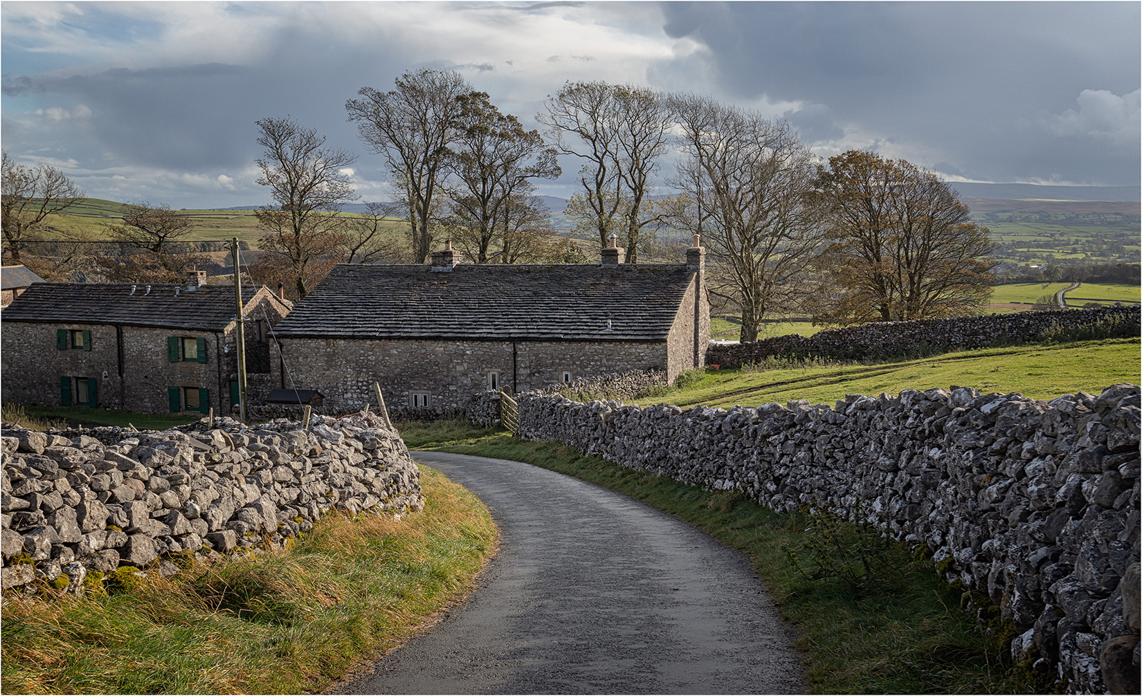
The car park for Ingleton Falls is located just outside the village of Ingleton. If travelling from the west, the falls are signposted at the junction of the A65 and the A687 just before reaching Ingleton. Turn left here onto New Road and follows this for just under 1 mile to reach the car park. From the east, when reaching Ingleton on the A65, turn right onto Main Street, just after the B6255. Follow Main Street for 0.5 miles, then turn left over a pair of bridges over the Rivers Doe and Twist to reach the Falls car park.
The River Twiss
From the car park, the walk is initially fairly level, through an attractive woodland area. A notable feature that is passed is the Money Tree, a fallen tree with thousands of coins driven into the wood. In the autumn, it is worth keeping an eye out for mushroooms and funghi which thrive in the damp conditions. After a short walk, the narrow ravine of Swilla Glen is entered where the first minor cataracts are seen on the river.
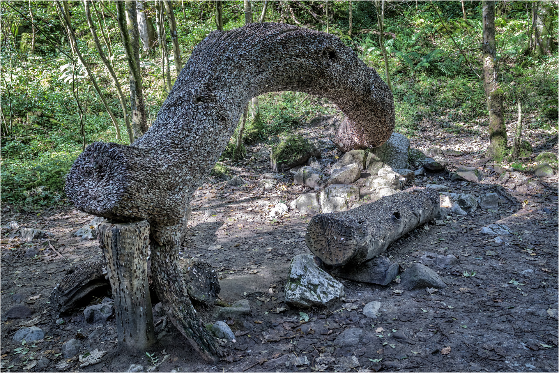
The Money Tree
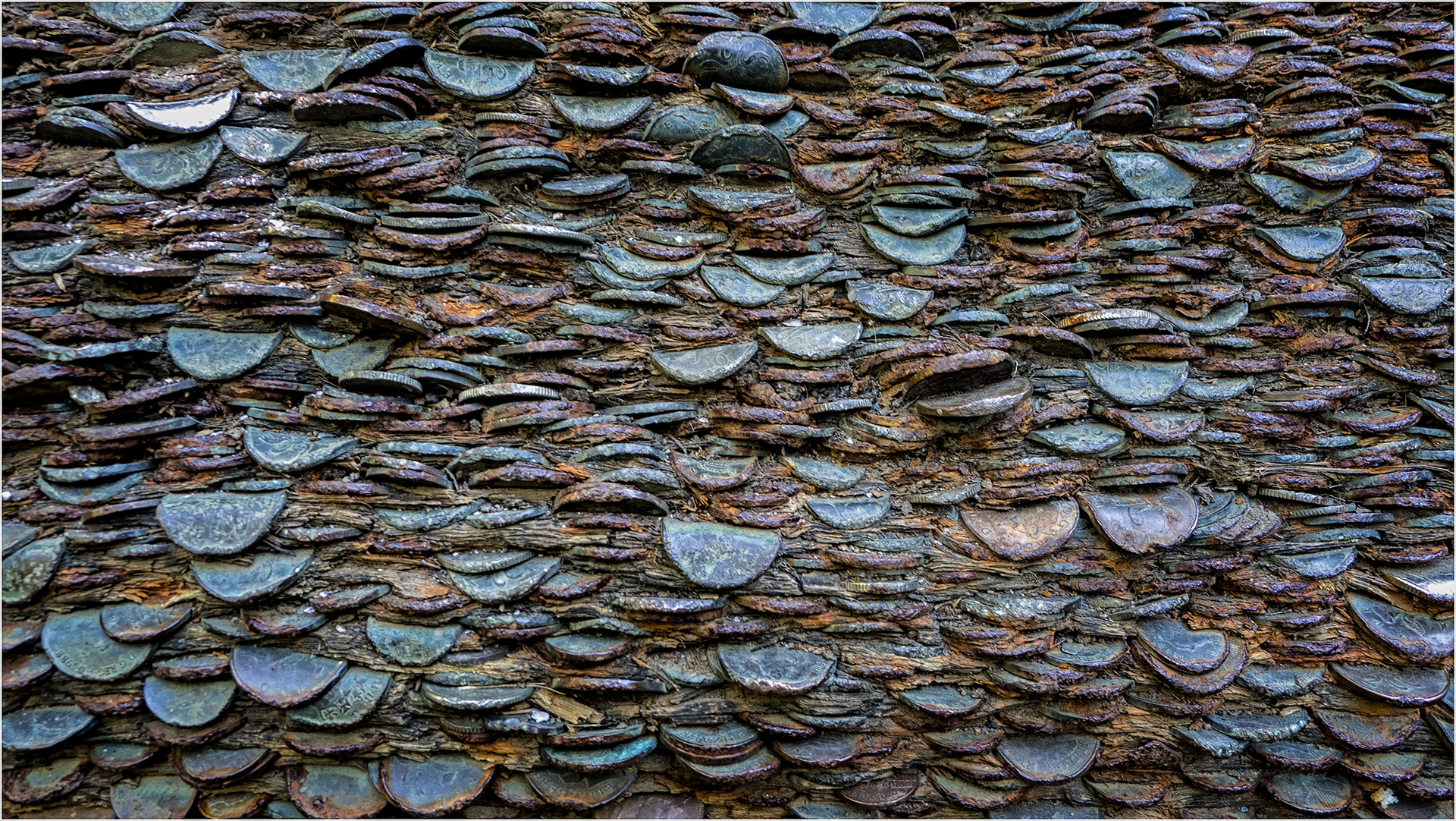
Money Tree Close-Up

Mushrooms at Ingleton Falls
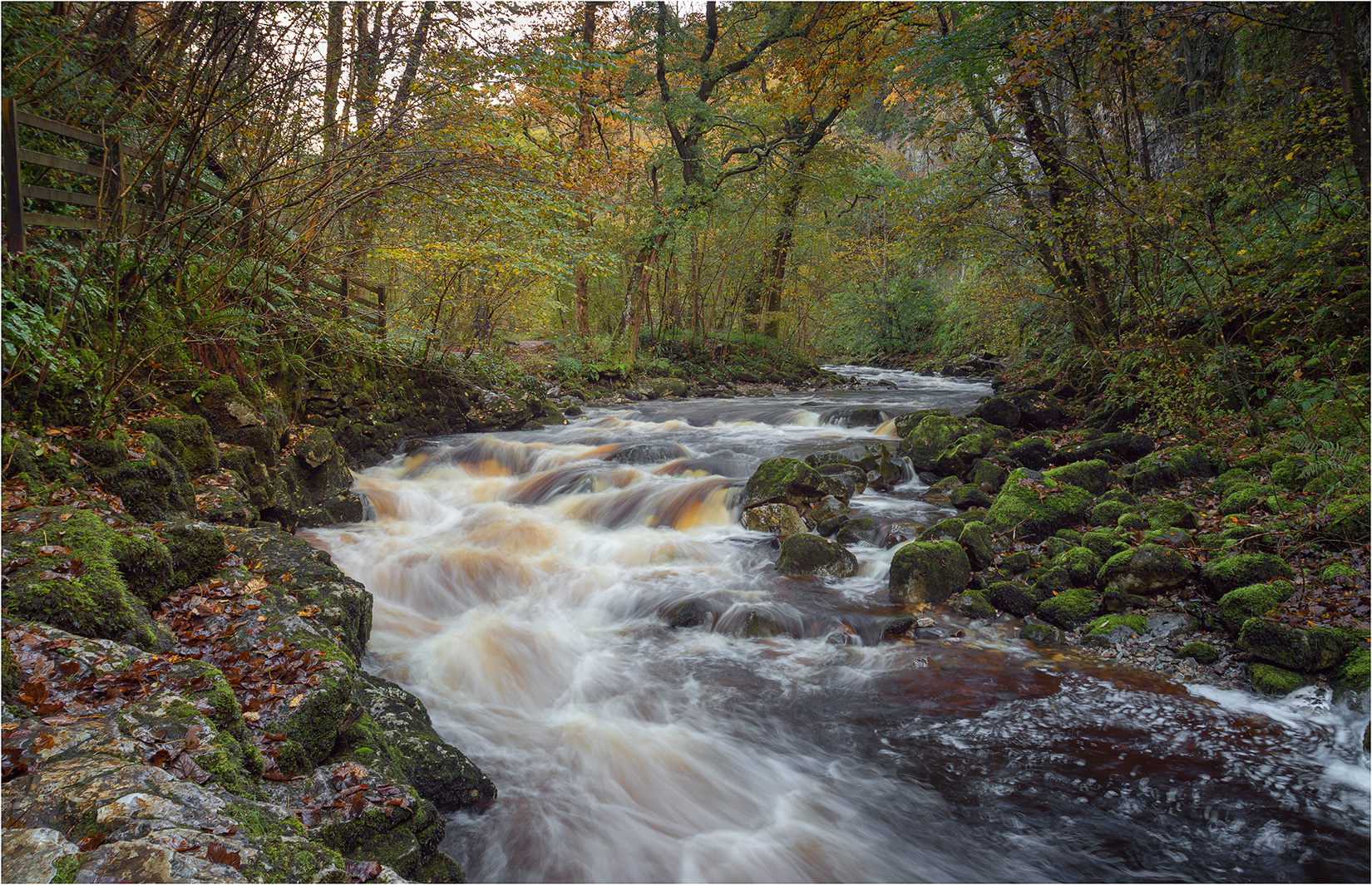
The River Twiss
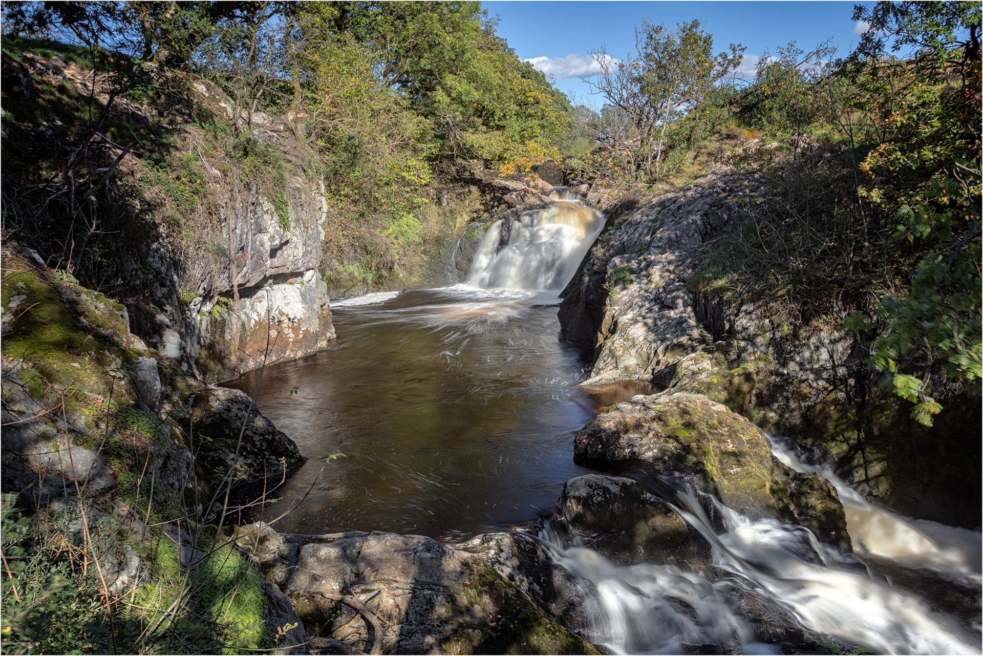
Pecca Falls
After crossing to the left bank of the river, the path climbs more steeply before re-crossing the river just below Pecca Falls. The path continues to climb past several falls to reach a refreshment kiosk, with more open country beyond the kiosk.
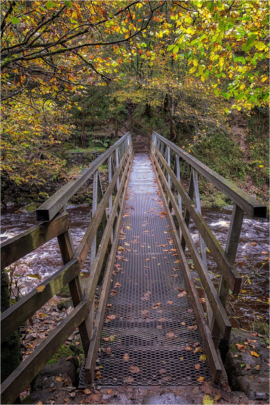
Manor Bridge Over The River Twiss
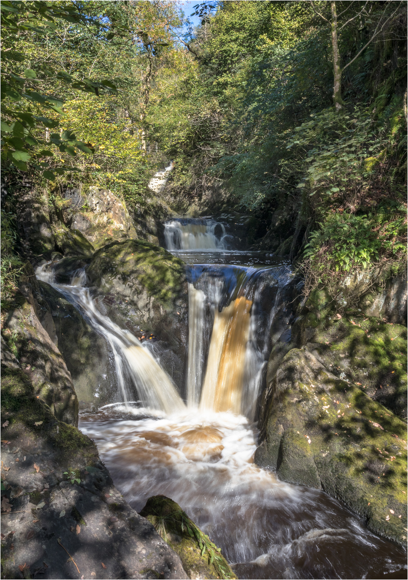
Pecca Falls
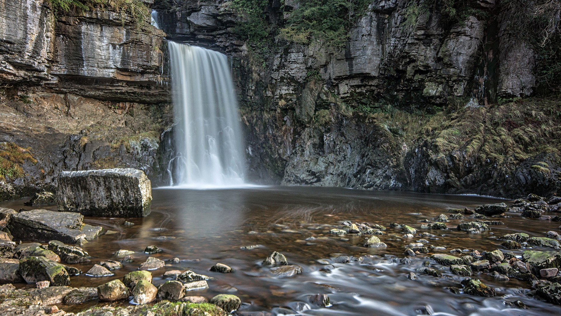
Thornton Force
The highlight of the walk is Thornton Force, which at 14m high is the largest waterfall on the walk, and is one of the finest waterfalls in England. The waterfall sits in an open limestone amphitheatre at the top of the walk up the River Twiss, so offers plenty of scope for different compositions using the river and rocks as a foreground. The walk the climbs up the side of Thornton Force, past some small cataracts to reach open moorland above, and a track which crosses to River Twist for the descent. Half way along this track, a path climbs the hillside to reach the limestone pavement of Twistleton Scar.
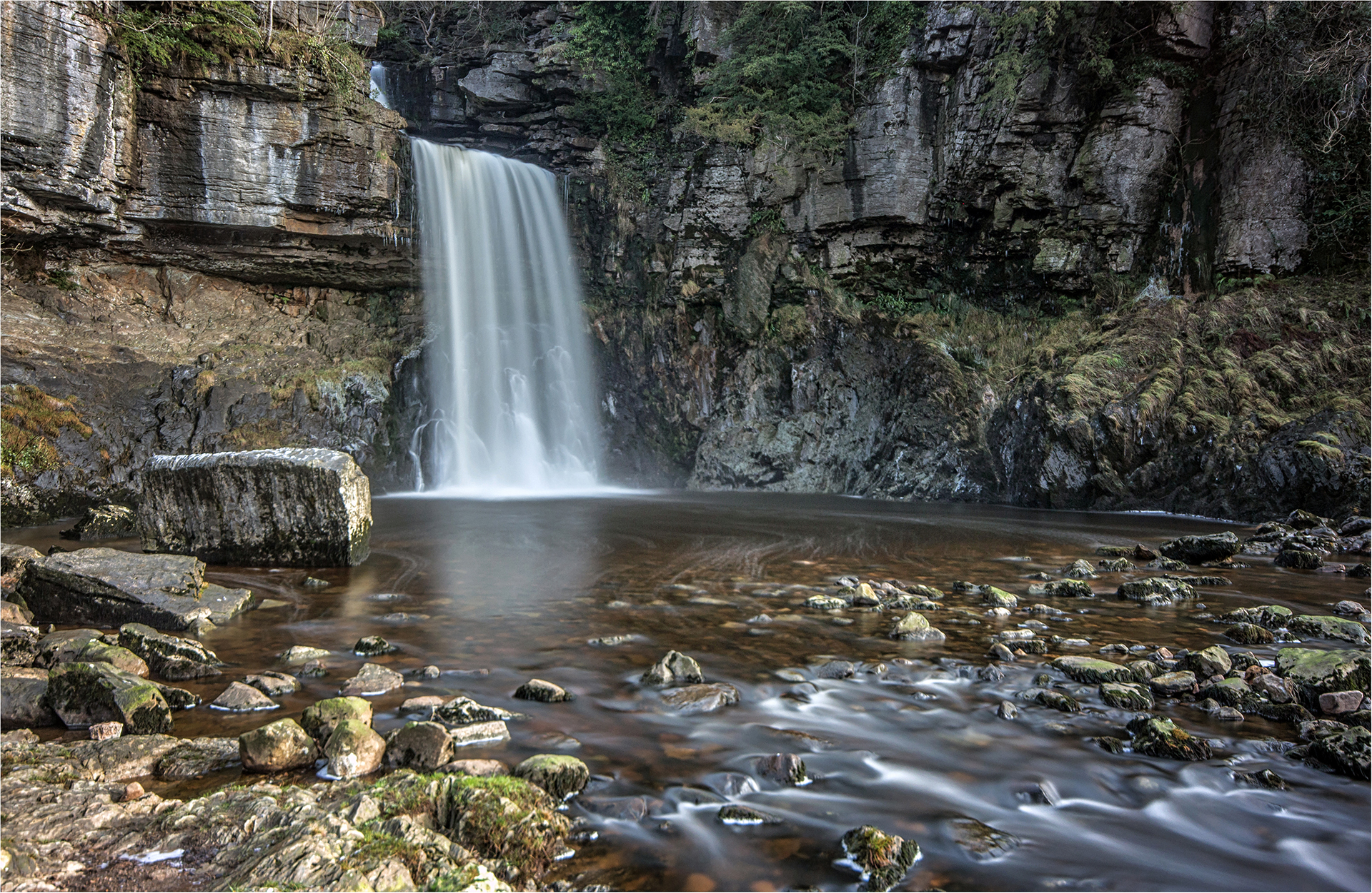
Thornton Force

Thornton Force
Cascades Above Thornton Force
Scar End and Ingleborough
After climbing above the River Twiss, the path reaches Twistleton Lane, a bridleway that gradually descends to Scar End farm and the River Doe for the return walk. Half way along the bridleway, a path branches off on the left, up the hillside towards Twistleton Scar. Once past Scar End farm, there are fine view towards Ingleborough.
Scar End Farm

Ingleborough from Scar End
The River Doe
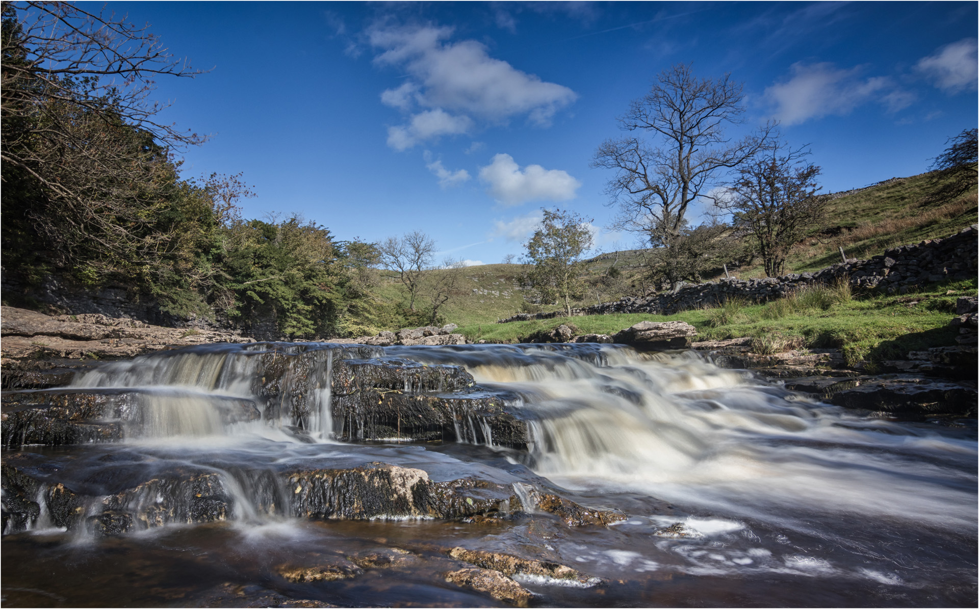
The descent alongside the River Doe passes Beezley Falls, Rival Falls, Baxenghyll Gorge and Snow Falls. At first the path remains close to the river, twisting and turning through narrow gorges, particularly at Baxenghyll Gorge where the river runs through a narrow gorge only a few feet wide. Lower down, the path takes a higher route through woodland, so the river is not so well seen. Finally, the river banks open up at Twistleton Glen, where there are some old lime kilns, and from there it is a level walk back to Ingleton and the return to the car park.
Upper Beezley Falls

Lower Beezley Falls
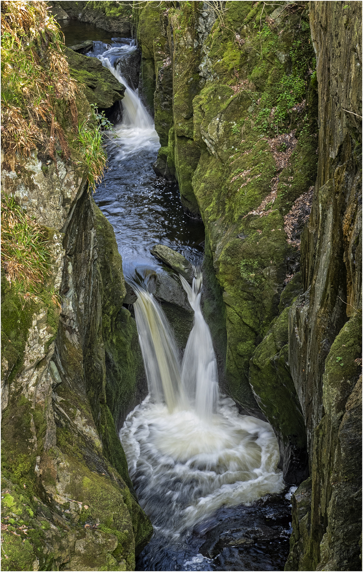
Baxenghyll Gorge

Twistleton Glen