Ennerdale is the most westerly of the major lakes in the Lake District, and as it has no road into the valley from the east, access from the main Lake District villages is somewhat difficult. There is no major village in the valley, and the road from the west only reaches the lake, so it is a long walk around the lake to the head of the valley. This all combines to make Ennerdale the quietest of the major Lake District valleys. The valley was extensively planted with conifers during the 1920’s, but more recently the trend has been towards regeneration – planting native species of trees and allowing the woodland to develop naturally. The valley is ringed by some of the Lake District’s most impressive mountains, Pillar and Steeple on the south side of the valley and the High Stile range to the north, however due to the long access routes, these are seldom climbed from Ennerdale.
 Location and Parking
Postcode: CA23 3AS or CA23 3AU
Ennerdale is accessible from the A595 on the West coast of Cumbria and is signposted from this road. There are two car parks, Ennerdale Water car park at the head of the lake, and Bowness Knott car park on the northern shore. To reach both car parks, drive through the village of Ennerdale Bridge then for the first car park, turn right after 0.5 miles and continue to the end of the road. For the Bowness Knott car park, keep straight on at the junction for a further 0.8 miles before turning right, and the car park is 2 miles along this road.
Crag Fell
There is a 6.5 mile walk around the lake, which can be started from either car park however our pictures were taken from the foot of the lake or from a walk up Crag Fell, the prominent fell on the right side of the lake. For the walk up Crag Fell, park at the Ennerdale Water car park and instead of walking to the lake, head south towards Crag Farm House, then turn right along a track bordering the forest. When the corner of the field wall on the right is reached, there is a small track left into the forest – this is easy to miss, but once on the track it is easy to follow uphill, until the open fell is reached, with views to the Loweswater Fells.
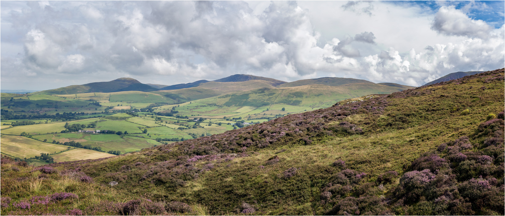
The Loweswater Fells from Crag Fell
Continue up the ridge and the summit soon comes into sight.
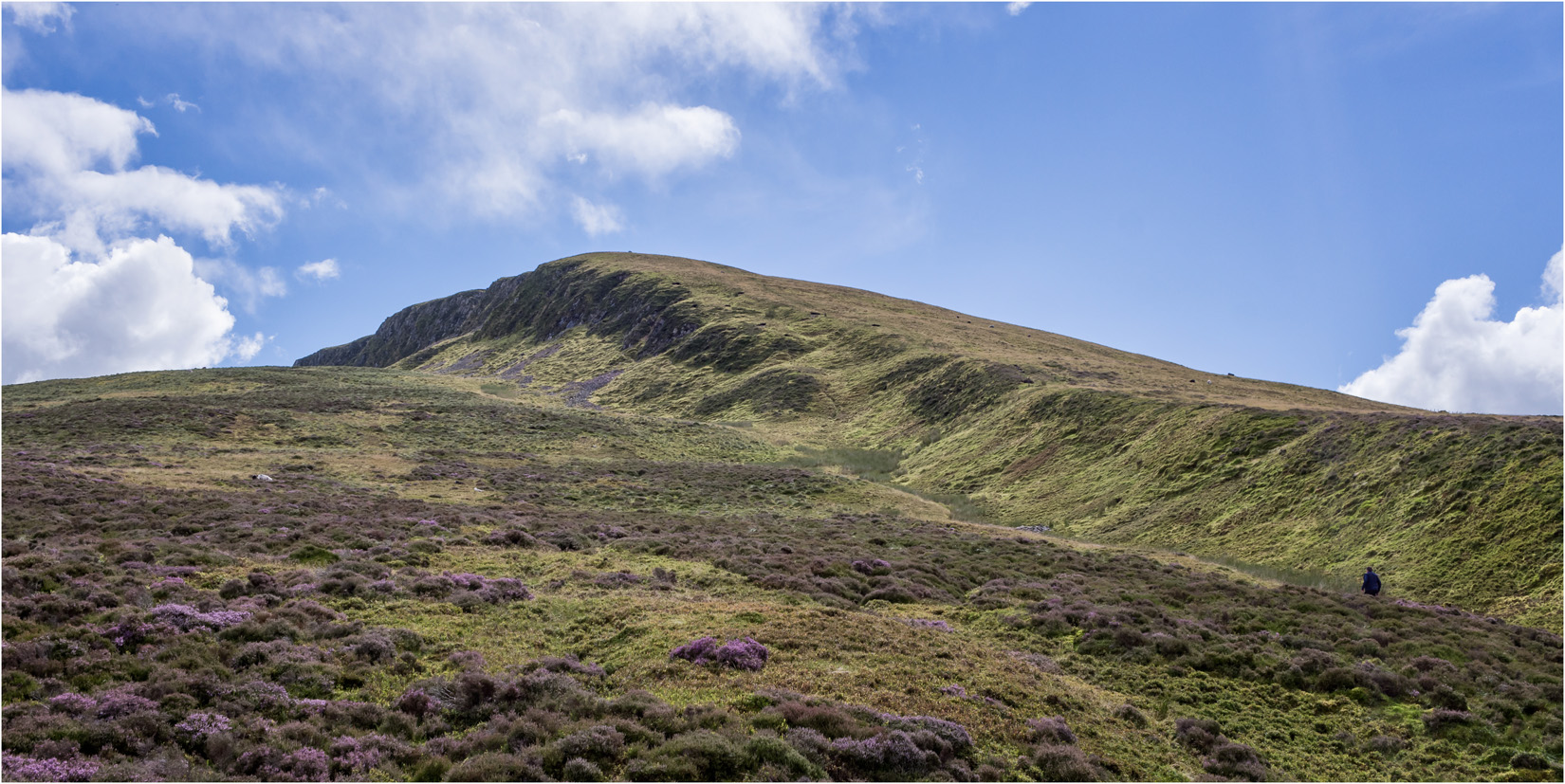
The Summit of Crag Fell
Close to the summit and there are fine views over Ennerdale Water, backed by the High Raise ridge.
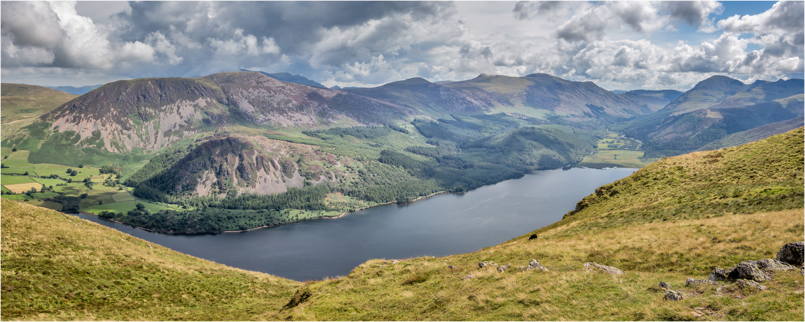
Ennerdale Water from Crag Fell
The summit is marked by a large cairn. Although the highest point, the view to the head of the valley is restricted by the surrounding high ground. A short walk westwards brings the head of the lake into view, with an attendant sheep in our case.
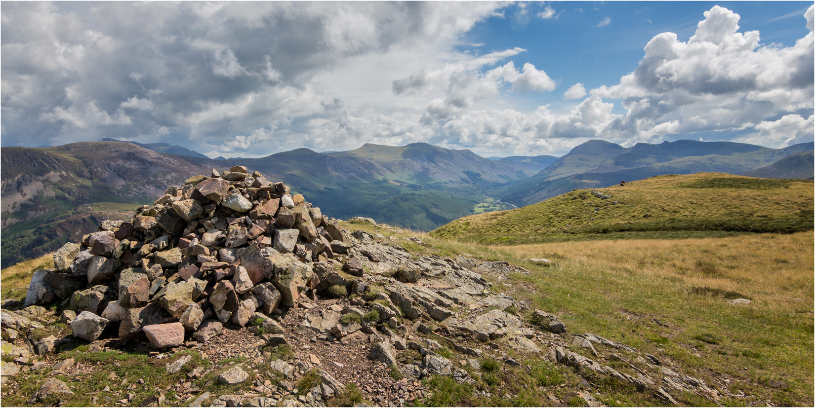
Crag Fell Summit

The Head of Ennerdale
The Head Of Ennerdale
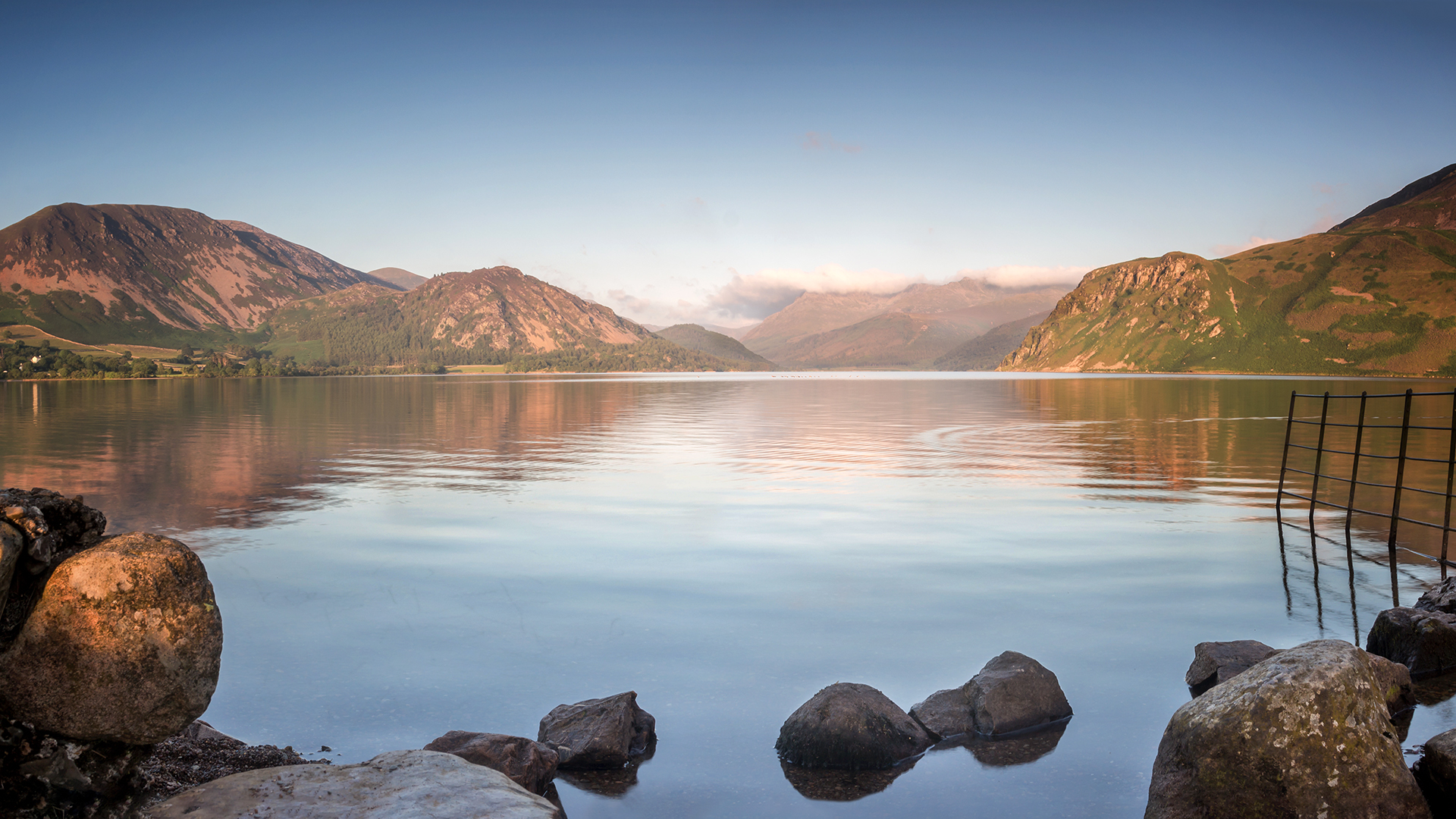
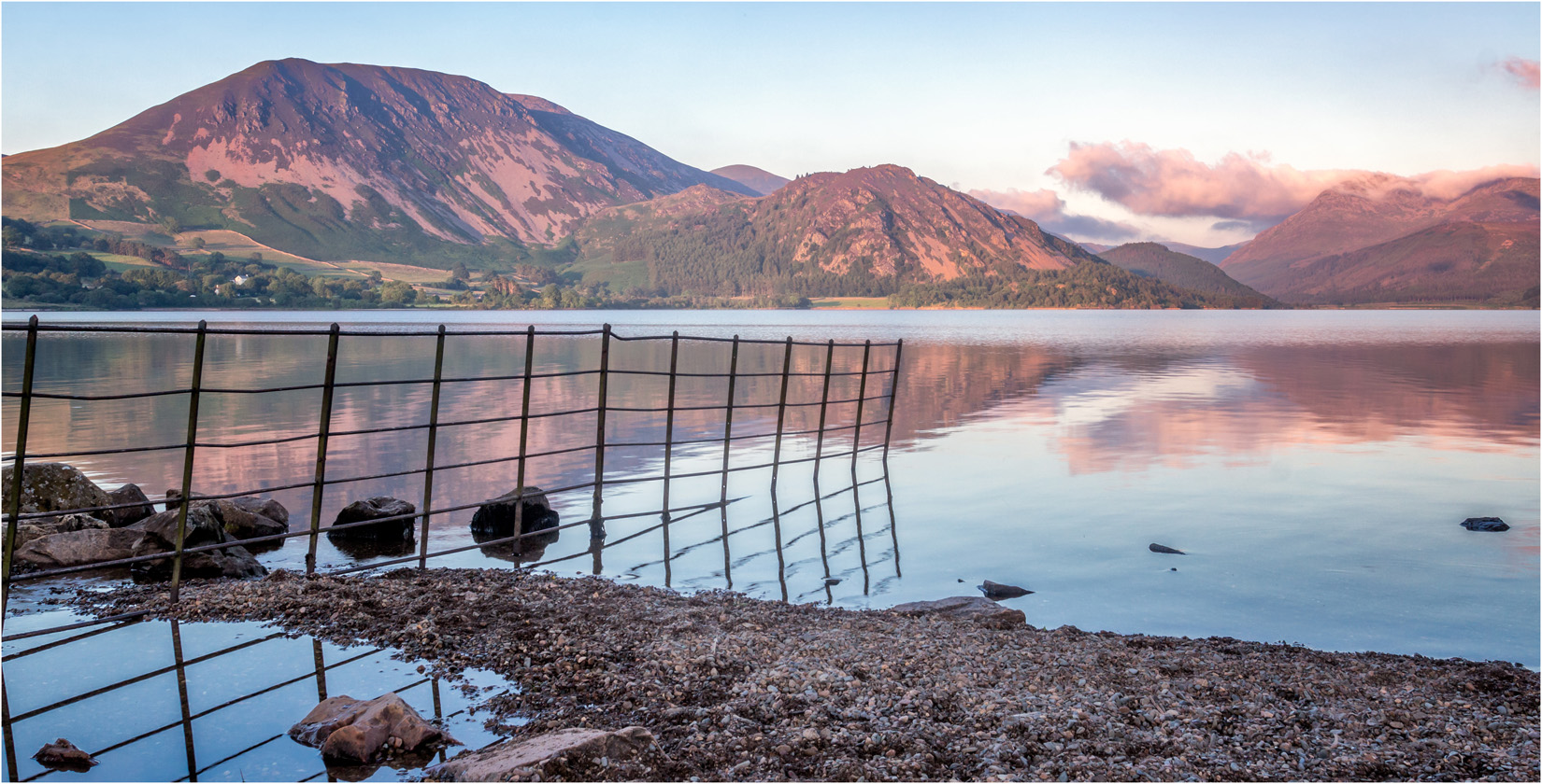
It is a very short walk to the lake from the car park. The head of the lake is a little featureless, but by turning left and following the lakes edge for a third if a mile, there is a fence running into the lake with a few rocks around to provide a little foreground interest. Crage Fell is to the right of the view and Great Borne to the left.
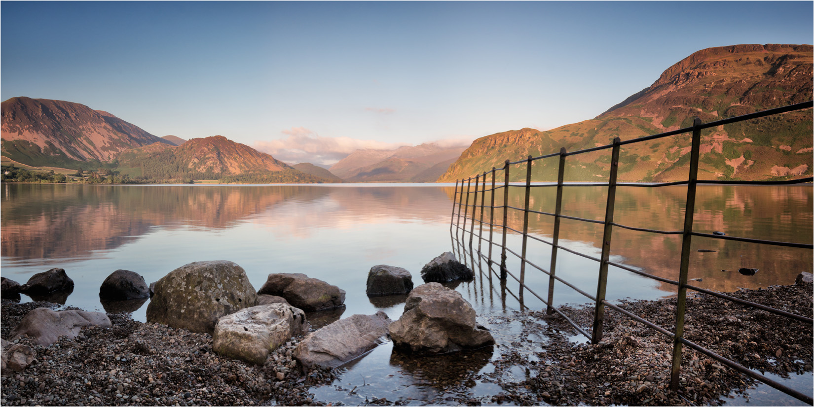
Ennerdale Water
Great Borne and Ennerdale Water
The view over the lake faces east, so with a clear sky, the setting sun can illuminate the mountains. If the shoreline is not included for foreground interest then the lake and mountain view can be photographed from anywhere along the lakeside path.
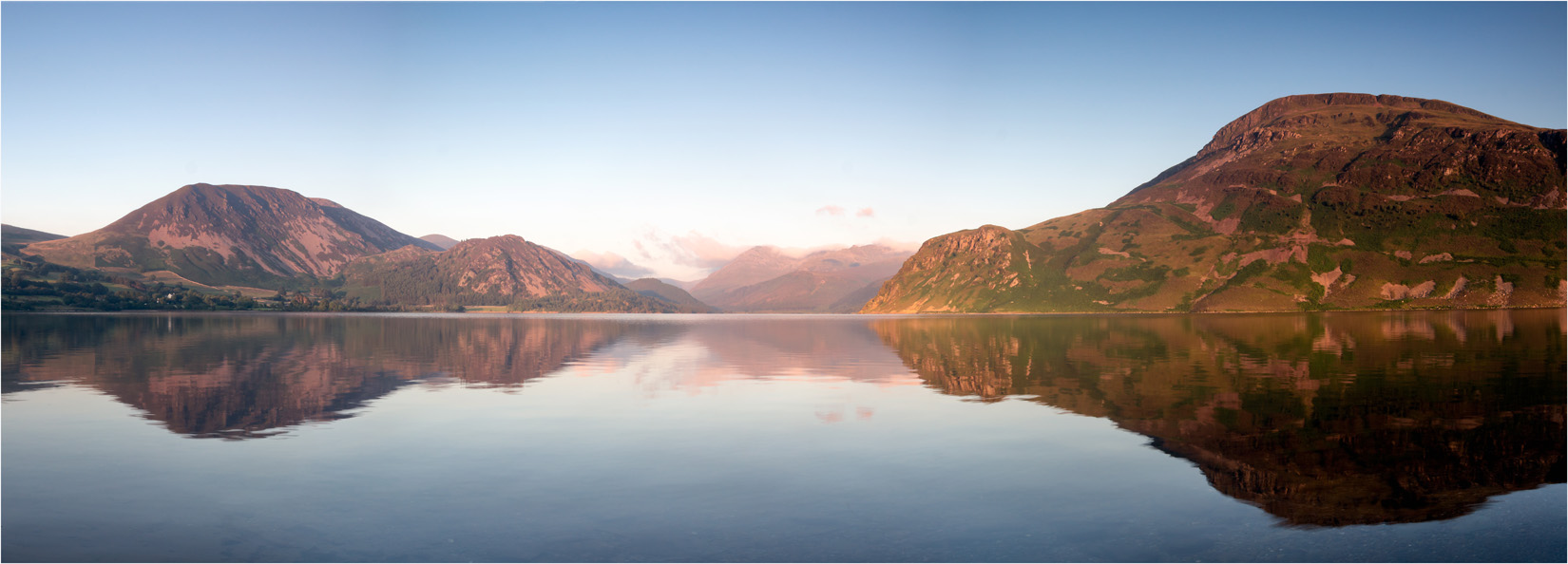
Evening Light on Ennerdale Water